Part I (viii) FIRs in India & principal comms/nav facilities · (x) Notices to airmen (NOTAM/AIS)
Learning objectives — by the end of this chapter you will be able to…
- Define an FIR and the related airspace structures (UIR, CTA, CTR, TMA), and the services provided within them.
- Name India's principal FIRs and decode an ICAO four-letter location indicator.
- Outline the ICAO airspace classes A–G and what each provides.
- State the principal communication, emergency and navigation frequencies used in India.
- Describe the AIS and the Integrated Aeronautical Information Package (AIP, AIC, NOTAM) and the NOTAM Q-line.
- Explain the AIRAC cycle and the AFTN with its message priorities.
5.1 How airspace is divided
5.2 Indian FIRs & the services
5.3 ICAO location indicators
5.4 Airspace classes A–G
5.5 Principal communication & emergency frequencies
5.6 Principal navigation frequencies
5.7 The AIS & the IAIP
5.8 NOTAM & the Q-line
5.9 AIRAC & AFTN

5.1 How airspace is divided
Airspace is too vast and varied for one office, one service and one set of rules. So it is divided two ways: horizontally and vertically into named blocks, and by class according to how much control and service is provided. The largest block is the Flight Information Region (FIR); within it sit smaller, more tightly controlled volumes around the busy parts.
FIR — Flight Information Region: a volume within which Flight Information Service (FIS) and Alerting Service are provided.
UIR — Upper Information Region: the FIR's upper-airspace counterpart.
CTA — Control Area: controlled airspace from a specified lower limit upwards (airways are CTAs).
TMA — Terminal Control Area: a CTA at the confluence of routes near major aerodromes.
CTR — Control Zone: controlled airspace from the surface upwards around an aerodrome.
ATZ — Aerodrome Traffic Zone.
An airspace of defined dimensions within which Flight Information Service (useful information for the safe and efficient conduct of flight) and Alerting Service (notifying the appropriate organisations of aircraft needing search and rescue, and assisting) are provided. An FIR may extend over the high seas (an Oceanic FIR).
5.2 Indian FIRs & the services
India's airspace is divided into the FIRs of Delhi, Mumbai, Kolkata and Chennai, with the Chennai (Oceanic) region extending far over the Bay of Bengal and Indian Ocean. Each is managed by the Airports Authority of India (AAI), which provides ATS, communications, navigation and surveillance within them.
Confirm the complete current list of Indian FIRs and any sub-FIRs (e.g. Guwahati), their boundaries and exact FIR location indicators from the current AIP. Boundaries/names change — quote the live AIP.
As you cross from one FIR to the next, control is handed from one area control centre to another and you change frequency on instruction. Over the ocean, where there is no radar or VHF, the Chennai Oceanic FIR uses HF and position reports (and increasingly CPDLC/ADS) to keep aircraft separated.
5.3 ICAO location indicators
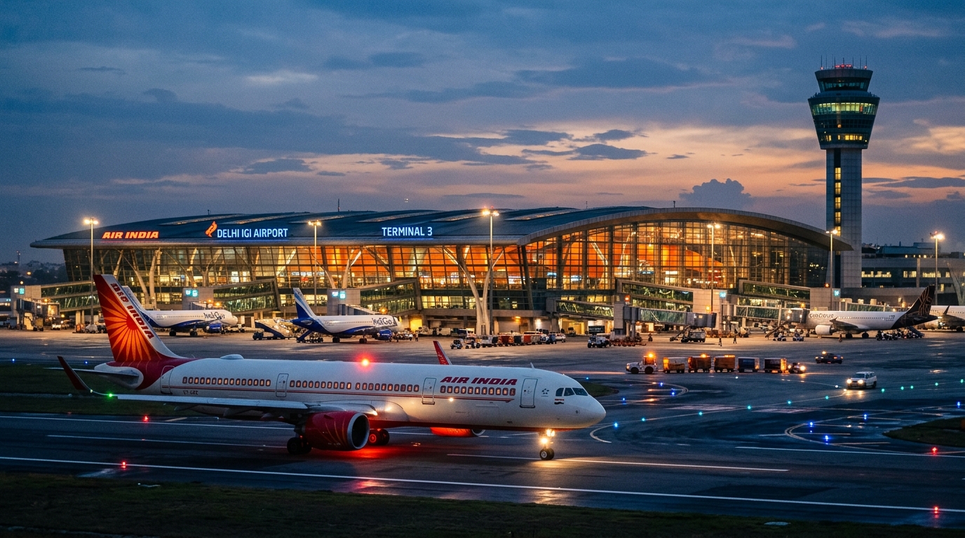
Flight plans, NOTAMs and messages must name aerodromes and stations unambiguously across the world, so ICAO assigns each a unique four-letter code. The letters are structured by region and territory so the code itself tells you roughly where you are.
1st letter = region; 2nd letter = State/territory within the region; 3rd–4th = the specific location. For India the first letter is V, and the second splits the country by zone (e.g. VI… north, VA… west, VE… east, VO… south). These are ICAO codes (4 letters), distinct from the IATA 3-letter codes used on tickets and baggage.
| Airport | ICAO (4-ltr) | IATA (3-ltr) | Zone letter |
|---|---|---|---|
| Delhi | VIDP | DEL | VI — north |
| Mumbai | VABB | BOM | VA — west |
| Kolkata | VECC | CCU | VE — east |
| Chennai | VOMM | MAA | VO — south |
India starts with V. The four metros by zone letter: VIDP, VABB, VECC, VOMM — "I-A-E-O" for north, west, east, south.
5.4 Airspace classes A–G
ICAO grades airspace from A (most controlled) to G (uncontrolled). The class decides whether you need a clearance, whether you're separated from other traffic, and what service you receive. You need to recognise the spread, not memorise every cell.
| Class | Flights | Separation / service (summary) |
|---|---|---|
| A | IFR only | All separated; ATC clearance required |
| B | IFR & VFR | All separated from all |
| C | IFR & VFR | IFR separated from IFR & VFR; VFR get traffic info on other VFR |
| D | IFR & VFR | IFR separated from IFR; traffic info on VFR |
| E | IFR & VFR | IFR separated from IFR; VFR not separated; controlled for IFR |
| F | IFR & VFR | Advisory service to IFR (where provided) |
| G | IFR & VFR | Uncontrolled — flight information service only |
A is for "All controlled"; G is for "Go as you please" (uncontrolled).
Control and separation steadily decrease from A to G.
Confirm which airspace classes India actually uses and their VMC minima from the current AIP/CAR, and insert exact figures if examinable.
5.5 Principal communication & emergency frequencies
Within India you talk to ATC on the VHF aviation band; long-range/oceanic uses HF; and a small set of emergency frequencies is guarded worldwide. The full spectrum is in Chapter 8; these are the ones the examiner expects you to name.
| Use | Frequency / band |
|---|---|
| VHF ATC voice | 118.0 – 136.975 MHz (AM, line-of-sight) |
| VHF emergency (international guard) | 121.5 MHz |
| UHF military emergency | 243.0 MHz (= 2 × 121.5) |
| ELT — satellite / homing | 406 MHz / 121.5 MHz |
| SAR scene-of-search (aux) | 123.1 MHz |
| Maritime distress (HF/MF) | 2182 kHz |
| HF long-range / oceanic voice | 3 – 30 MHz (SSB) |
121.5 MHz is the international VHF emergency (guard) frequency — memorise it exactly. Don't confuse it with the UHF military guard 243.0 MHz, and note 123.1 MHz is the SAR auxiliary scene-of-search frequency.
5.6 Principal navigation frequencies
| Aid | Frequency / band |
|---|---|
| NDB / ADF | LF/MF ≈ 190 – 1750 kHz |
| VOR / ILS localizer | VHF 108.0 – 117.975 MHz |
| ILS glide path | UHF 329 – 335 MHz |
| Marker beacons | 75 MHz |
| DME | UHF 962 – 1213 MHz |
| SSR transponder | 1030 MHz interrogate / 1090 MHz reply |
These frequencies and the facilities available at each aerodrome — runway, elevation, beacon idents, frequencies — are exactly what you look up in the AIP before flying there. Which brings us to the information system itself.
5.7 The AIS & the IAIP
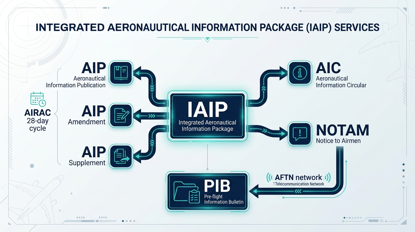
You cannot personally survey every runway or measure every beacon. Someone collects that data, publishes it, and — critically — keeps it current. That is the job of the Aeronautical Information Service (AIS), and its output is bundled as the Integrated Aeronautical Information Package (IAIP). Different kinds of information change at different speeds, so the package has different components for permanent, long-temporary, and short-notice data.
AIP — Aeronautical Information Publication: the permanent reference manual, in three parts — GEN (general), ENR (en-route) and AD (aerodromes).
AIP Amendment — permanent changes to the AIP.
AIP Supplement — temporary changes of long duration.
AIC — Aeronautical Information Circular: explanatory/advisory information not meeting NOTAM or AIP criteria.
NOTAM — short-notice, time-critical changes (see 5.8).
Plus pre-flight and post-flight information bulletins.
AIP = permanent · Supplement = long temporary · AIC = advisory · NOTAM = urgent/now. The faster the information changes, the further "down" this list it lives.
5.8 NOTAM & the Q-line
A Notice to Airmen — a notice distributed by telecommunication containing information on the establishment, condition or change in any aeronautical facility, service, procedure or hazard, the timely knowledge of which is essential to personnel concerned with flight operations.
NOTAMN — new · NOTAMR — replaces a previous NOTAM · NOTAMC — cancels one. Specialised: SNOWTAM (runway snow/ice/slush conditions, a special format) and ASHTAM (volcanic ash). The summarised set for a route is issued as a PIB — Pre-flight Information Bulletin.
Each NOTAM carries a coded Q-line that lets computers filter and route it: it encodes the FIR, a Q-code subject & condition, the traffic affected (I/V), the purpose, the scope, and the lower/upper limits and a radius. Below the Q-line, items A) to G) give the aerodrome/FIR, start and end times, schedule, and the plain-language text.
A NOTAM reads, in part: "A) VIDP B) … C) … E) RWY 11/29 CLSD DUE WIP."
A) = the aerodrome (Delhi, VIDP). B)/C) = valid-from / valid-to times (UTC).
E) = the plain text: runway 11/29 closed due work in progress.
So at Delhi, for the period in B)–C), you must plan around runway 11/29 being unavailable. This is exactly the kind of item the PIB surfaces before you fly.
N-R-C: New, Replace, Cancel — a NOTAM is freshly issued, takes the place of an old one, or kills one.
5.9 AIRAC & AFTN
Aeronautical Information Regulation And Control — a system delivering operationally significant changes on common effective dates at fixed intervals of 28 days, so that crews, databases and States all update together rather than at random.
NOTAMs, flight plans and service messages travel over the AFTN — Aeronautical Fixed Telecommunication Network, a worldwide ground network of fixed stations exchanging messages in a standard format with priority indicators. In descending priority: SS Distress, DD Urgency, FF Flight safety, GG Meteorological, KK Flight regularity (and lower categories for administrative/service messages).
"Some Dogs Find Good Kennels" → SS Distress, DD Urgency, FF Flight-safety, GG Met, KK Regularity.
☆ Numbers to memorise
| Fact | Value |
|---|---|
| FIR | Airspace with Flight Information Service + Alerting Service |
| Indian FIRs | Delhi, Mumbai, Kolkata, Chennai (+ Chennai Oceanic) |
| Location indicators | VIDP · VABB · VECC · VOMM (India = V, 4 letters) |
| Airspace classes | A (all controlled) → G (uncontrolled) |
| VHF ATC band | 118.0 – 136.975 MHz |
| VHF / UHF emergency | 121.5 MHz / 243.0 MHz · SAR aux 123.1 |
| IAIP | AIP (GEN/ENR/AD) · Amendment · Supplement · AIC · NOTAM |
| NOTAM types | NOTAMN (new) · NOTAMR (replace) · NOTAMC (cancel) |
| AIRAC cycle | 28 days |
| AFTN priorities | SS · DD · FF · GG · KK (distress → regularity) |
Part A — MCQs (click an option to check)
Part B — Oral / viva (tap to reveal model answers)
60-SECOND REVISION CARD
- FIR = airspace with FIS + Alerting. India: Delhi, Mumbai, Kolkata, Chennai (+Oceanic). CTA/TMA/CTR nested inside.
- ICAO codes (4-ltr, India = V): VIDP, VABB, VECC, VOMM. Classes A (all controlled) → G (uncontrolled).
- VHF ATC 118–136.975; emergency 121.5/243.0, SAR aux 123.1.
- IAIP = AIP (GEN/ENR/AD) + Amendment + Supplement + AIC + NOTAM. NOTAM = N/R/C, SNOWTAM/ASHTAM.
- AIRAC = 28 days; AFTN carries messages, priorities SS·DD·FF·GG·KK.